2016 marked the 60th year of the Duke of Edinburgh’s Award Scheme. The scheme is a youth awards programme that recognises adolescents and young adults for completing a series of self-improvement exercises.
For it’s 60th anniversary the scheme issued a “Diamond Challenge” as a method of raising awareness and funding for the scheme. People of all ages were asked to set themselves a personal challenge and to raise a minimum of £60 for the scheme. My wife Linda and I took on the challenge and decided we would climb the highest 20 “Hewitts” in Wales. A Hewitt being a hill of minimum height of 2000ft and with a drop of at least 30ft all round.
By the time we’d completed the challenge we’d raised almost £500 for the D of E and had some great days in the hills including some we’d never been up before. Once or twice we stretched ourselves almost too far and we learnt something about a weakness or two in our hill-walking skills. The entries below document our days on the challenge.
Cadair Idris – Hill 1
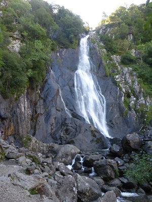
The first hill we took on for the challenge was Cadair Idris. This stands on the southern end of the Snowdonia National park and is about a 3 hour drive from home so is just about doable as a day trip.
For this challenge we decided on ascending the south side from the Dôl Idris car park and following the Mynfordd path up through the ancient oak woods to the entrance of Cwm Cau.
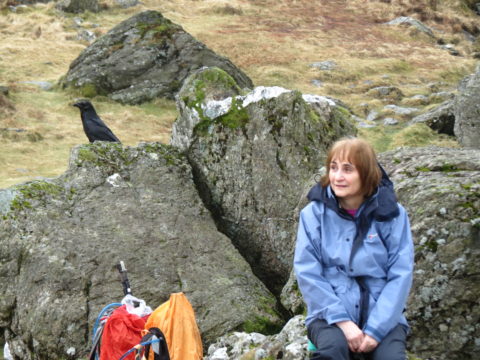
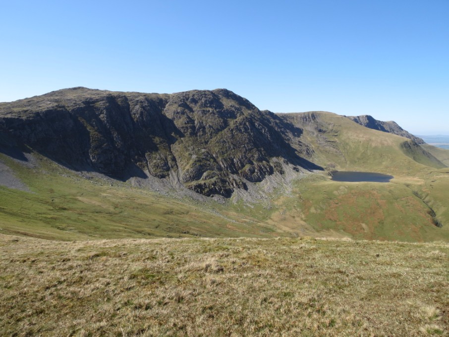
Following the path round into Cwm Cau we passed the erratic boulders left by the glacier that carved out the cwm and stopped to rest on the rock outcrop overlooking Lyn Cau whilst deciding our next move. We were joined here by a large crow and a couple of gulls vying for the best perch on the rock
Rested, we went off to the right and round to the far end of the Lyn before scrambling up the stone chute to Bwlch Cau before resting again, only to be joined by “our” crow once more!
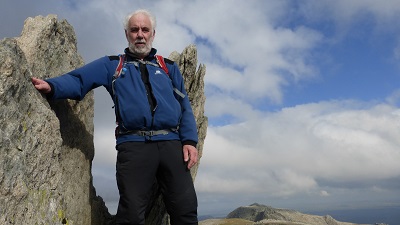
From the Bwlch there is another climb up up to the summit with its large cairn and stone shelter where we attempted to take summit pictures which for some reason failed, but we did get a picture of the Penygadair summit from our lunch spot sitting on a small outcrop a little away from the summit looking north to the rest of Snowdonia just out of the wind.
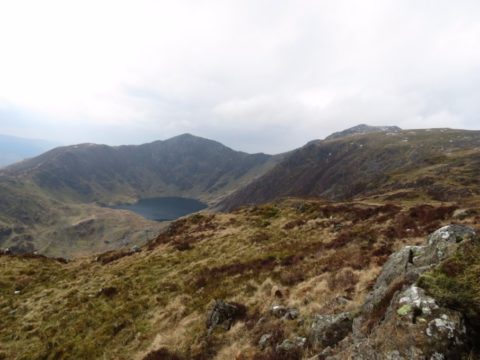
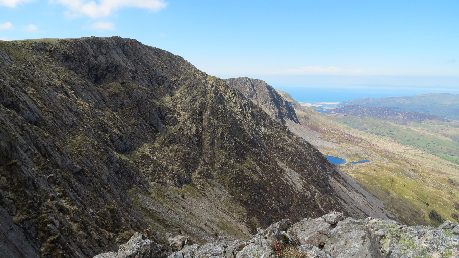
Descending we headed in an easterly direction dropping down slowly south until we found the style over the fence that leads down from Mynydd Moel. It’s on this leg of the walk that you get the best views down into Cwm Cau with the huge cliffs of Craig tumbling into the Lyn.
Crossing the style we followed the fence down steeply (very!) towards Moelfryn before rejoining the Mynfford path back to the carpark.
A good day, and a good start to our challenge.
The Arans – Hills 2 &3
For our second foray we decided on Aran Fawddwy and Aran Benllyn. These two lie together on a ridge stretching south west from Bala and many people tackle the hills from this direction. We decided instead to approach via Cwm Cywarch, a stunning valley accessed off the A458 at Dinas Mawddwy.
Driving right to the end of the road there is now a car park replacing the need to find a spot on the roadside, complete with a portaloo and donation box for the Mountain Rescue Team. We started by taking the path now diverted past the farm buildings and following the stream up to the head of the Cwm.
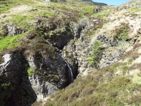
Gradually the stream becomes hemmed in and becomes a series of small waterfalls. Walking beside it almost made us forget we were trudging uphill, but we were soon up on the ridge.
We could have turned left and picked up Glasgwm as added extra but left it for another day because (to be honest) it’s not on our list!
The walk along the ridge to the top of Aran Fawddwy includes a long boggy strip which helpfully has a plank pathway liad out across it. However they’ve been there for a while and need to be treated carefully else a wet boot is the likely outcome.
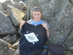
Soon enough we were faced with the final climb to the cairn. This is a memorial to Michael Aspain, a RAF Mountain Rescue team member who was killed by lightning in 1960. From there Aran Benllyn is an out and back trip along the ridge.
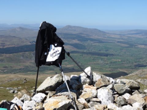
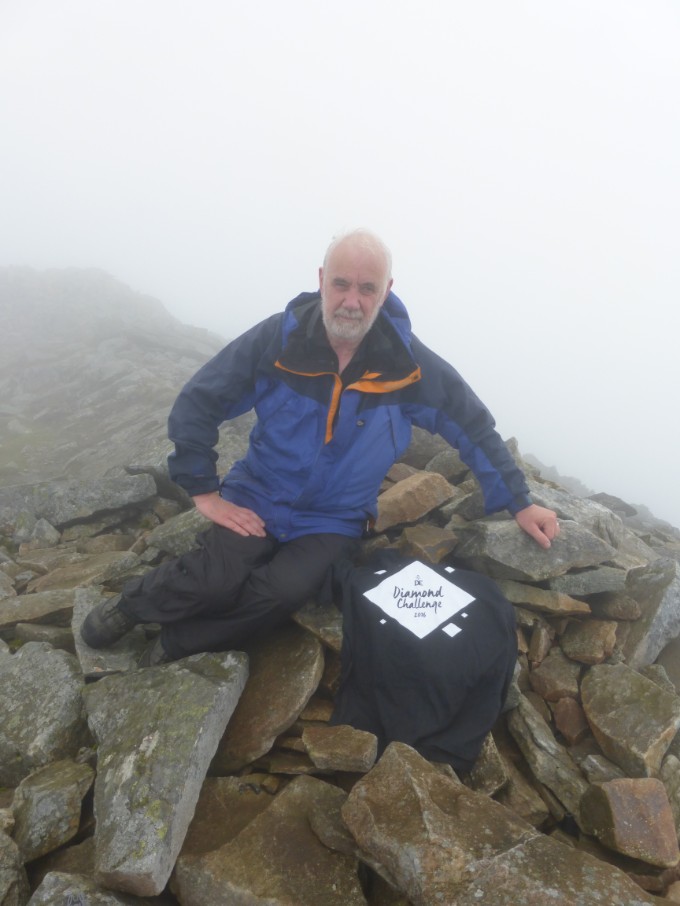
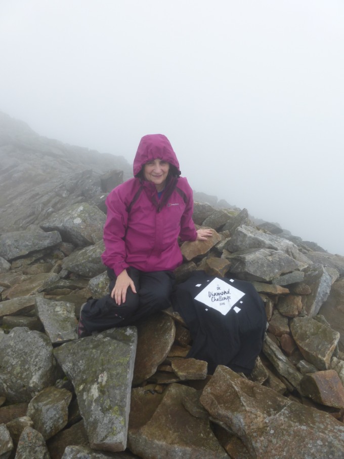
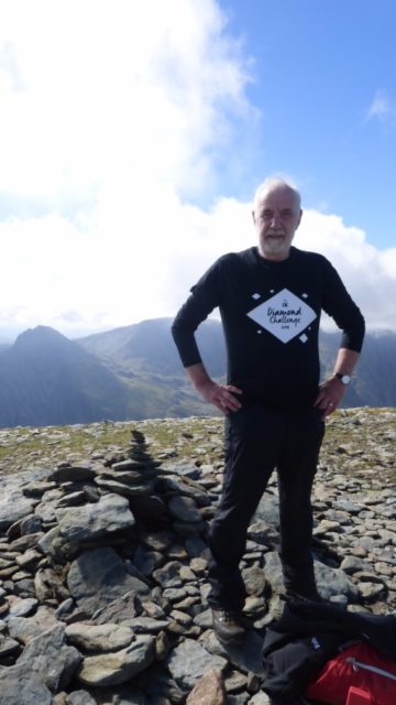
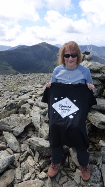
At this point we finally remembered that we had our Diamond Challenge T-shirts with us but were still coy about posing in them – so we constructed a tripod with our trekking poles and draped one over that.
Arriving back at the summit of Aran Fawddwy we descended the ridge to Drysgol and worked our way back to the car on the gentling sloping path on the flanks of Pen y Alt Uchaf.
This was the first time we’d ventured out this way and it’s a walk we’d recommend. Great views, great walking – and very quiet!
Elider Fawr – Hill 4
After the first three hills were completed we took a long break and it wasn’t until September that we got back onto the challenge. (Part of the reason for that was that we’d spent time in Cumbria adding to our collection of Wainwrights). Combining the challenge with a week’s holiday, we rented a cottage in Betwys-y-Coed for a week with view to climbing as many of the Snowdonia peaks as we could whilst there.
For a relatively gentle start we picked Elider Fawr, a shapely peak jutting out from the seaward end of the Glyder’s ridge line.We approached it from the Marchlyn Mawr reservoir road near Deiniolin, following it past the quarry and Marchlyn Bach round underneath the flanks of Carnedd Filiast before setting off up the steep path onto the ridge. As we set off it from the road it began to rain but luckily it was short lived although clouds persisted on the tops all day.
After the first top navigation became tricky with very limited visibility on the wide ridge towards Mynydd Perfedd. We knew we had to break off to the right, but where? Whether we found it by luck or pin-point navigation is up for debate, but find it we did and soon the ridge narrowed and we started the climb to the top of today”s Hewitt. The top felt quite “pointy” but we couldn’t really tell as we couldn’t see more than a few yards!
Pictures taken we pondered the way down for a while, resisting the getting the compass out for just long enough for a slight break in the clouds to let us see a style in the fence with path leading in the right direction. We followed the path down and then along to Elider Fach before turning to get back to our start point.
We were just a little surprised to pop out of the clouds above the Llanberis slate quarry and a check of the map showed we were had some how veered too far west, A sharp right turn for a couple of hundred metres put us back on track, but did nothing for my blushes. More map interpretation lessons needed I think. The way down soon became clear as we dropped out of the clouds. no path was evident so we fiddled our way between rocks until we hit the final grassy slope to the road.
A successful start to the week with new hills climbed and legs stretched. (Unfortunately we have no pictures other than summit ones – clouds aren’t very photogenic when you’re inside them!)
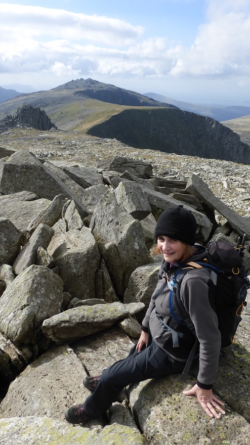
Southern Carneddau – Hills 5, 6, 7, 8
There are seven Hewitts in the Carneddau, the northern most group that we needed to tick off. They are pretty spread out and there are walkers who apparently do them all in one day. We weren’t looking to push our limits that far and in any case there are two good days on the hill to be had by splitting then up.
Day one then, the southern Carneddau made up of Pen-yr-ole-wen, Carnedd Dafyfd, Carnedd Llewelyn and Yr Elen. After spending all the day before in rain and mist it was good to see the clouds just brushing the tops and we were hopeful they would continue to rise.
After some research we had found a route up Pen-Yr-Ole-Wen that involved a little scrambling, much to Linda”s delight. The start is from the A5 in the Ogwen valley, initially up the lane past the Midland Mountaineering Club’s hut at Glan Dena and then up through wet fields guided by a hard to follow set of posts.
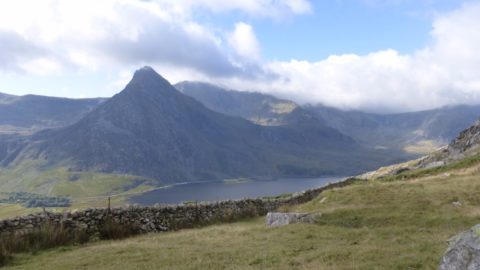
The path becomes clearer as you approach the mountain wall and leads up to FFynon Lloer. By now clouds were well above us and we had extensive views across to the Glyderrau, particularly a look at Tryfan from a different perspective than the one that the tourists see from the road and visitor centre.
Round the cwm and then a short scramble up a ridge and we were pretty much on the top, a short pause for pictures and then an easy stroll along the ridge past Carnedd Fach to Carnedd Dafydd. With the forbidding “Black Ladders” to our left keeping us honest we set off towards Carnedd Llewelyn but since the route drops down quite a lot before climbing to the summit we decided on contouring round towards Yr Elen to avoid climbing Llewelyn twice.
We found something that looked like a path heading in that direction but of course just when it was too far to go back it completely disappeared leaving us with a yomp across rough grass. But it worked and we were soon on the narrow ridge leading to Yr Elen.
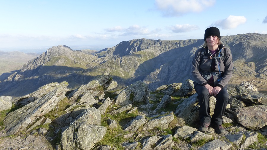
Summit Pictures
Northern Carneddau – Hills 9, 10, 11
There are some days in the hills that thrill and depress in equal measure and this turned out to be one them. If we have a fault in our hill-walking makeup it is that we occasionally decide to go “off-piste” in search of better ways up or down. Almost every time this turns out to be a mistake and this day was no exception.
We were staying in Betws-Y-Coed so the day started off with a drive up Conwy on the north coast, down the A55 to Abergwyngregyn and up the lane to the Aber falls car park. This is a touristy spot and from it a gentle path leads up to the falls. We carried out past these to the left and followed the head of the valley round until we came to a stream where there is apparently a path that leads uphill to the ridge. If it’s there we couldn’t find it, map and guidebook disagree and it seems map is correct! Instead we battled uphill following several bits of paths that kept disappearing until we saw what looked like an escape route to the left. A 2 metre wide path rose steeply uphill to the ridge so we abandoned our guidebook and went for it.
Mistake – just over the ridge it abruptly turned into a faint sheep track! The next hour or so saw us getting more and frustrated as, despite always knowing exactly where we were and where we needed to get to we could find no decent walking. So we were left with a yomp across boggy ground until finally after much swearing and a wet foot or two we reached Bera Bach. From here it’s a lot easier, just a stroll past Yr Aryg along the ridge to our first top. In 2009 this Hewitt changed names and is no longer Carnedd Uchaf but is called Carnedd Gwenllian. This was after a campaign by the Princess Gwenllian Society to have the peak named after Gwenllian of Wales who was the only daughter of the last Prince of Wales before conquest by England.
The top itself is marked by a pile of rocks and we sat there for a while calculating if we had time for the out and back to Foel Grach, as we had deadline of 7pm when the car park would be locked. Despite it being just over a kilometre away and with a climb of around 100 metres we decided we did and we were right, in a bit less than 2o minutes we had our second top of the day.
After a brief summit picture stop we headed back to Carnedd Gwenllian this time skirting past the pile of rocks that mark the summit set off towards Foel Fras. This top lies on a wide plateau with a good wall acting as a handrail. For the first time today we were treated to a proper trig point to stand next to. (and tap of course, you have to tap trig points as you pass, it’s the law!)
All that remained was to find a way down. We knew there was no path to follow. Our choice was between heading diagonally down towards Afon Goch or to go over Lywtmor. Guidebooks will encourage you to carry on to Drum and then follow Afon Anafon back but we didn’t have time for this. We decided on the Afon Goch route and headed off slight north of west towards the valley. As we neared the stream the going got fairly rough for a while but eventually after a couple of down scrambles over rock outcrops we hit the path leading back to the top of the falls.
A slippery traverse rocks with the falls to our left and then across a scree slope and we back in the valley and reversing our walk in from the car park. Here we were among those sensible holiday makers who stick to the valleys and on the way back to the car I had a chat with an chap who had planted himself on a large rock by the path and was chilling in the sun whilst waiting for his family who had, he claimed gone hunting for dwarves in the wood! I suspect a rouse for a quiet break.
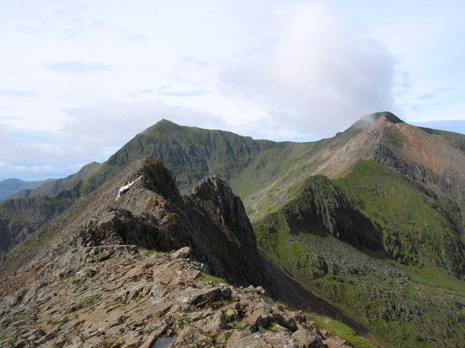
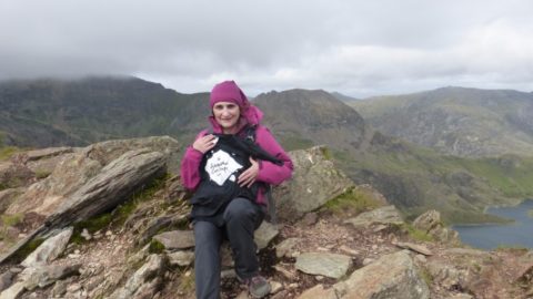
Snowdon Horseshow – Hills 12, 13, 14, 15
We had one walking day left and could either finish our week in Snowdonia with Tryfan and the Glyders or take on the Snowdon Horseshoe. We knew we would have to come back on a weekend to do one of these and decided that Snowdon would slightly less crowded on a Friday than a Saturday, so we got up early and headed to Pen-y-pass.
Even so the car park was almost full at 7:30am. We got away quickly and started up the PYG track towards Bwlch y pyg where we turned off and headed up the scramblto the end of the Crib Goch ridge.
(I heard a mother telling her kids we must be “proper mountaineers” to go that way. If only!)
At some point we got slight off the ridge which made our ascent more difficult but quite fun and soon enough topped out.
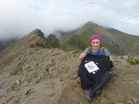
Ahead of us lay the crux of the days journey, Crib Goch ridge. The summit of Crib Goch is actually the first pinnacle on the ridge and is the other side of the scary bit.
However we did take the “summit pictures on the end of the ridge to try to get the whole thing. We set off across the ridge, which has a vertical drop one side and an almost vertical drop the other and got across ok but let’s not pretend we would get any points for style. Linda”s not too bad but these days I have developed enough vertigo to see me almost crawling across parts of it.
Once past the pinnacles the route becomes much less “interesting” and more enjoyable, good scrambling without the huge drops bring within inches. we took our time on these parts even so as it was quite blowy and the wind seemed to be increasing.
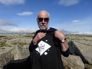
After Bwlch Coch the ridge widens a little and the climb to Crib y Ddysgl. The peak is shown on the OS Maps as Garnedd Ugain but I’ve never heard anyone call it that.
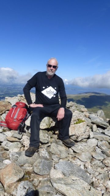
Either way it’s the second highest peak in Wales as was our second top of the day. On the peak the it was very gusty, despite me looking quite casual in the picture the T-shirt is plastered against the trip point by the wind.
From here there can be a fine view of Snowdon and also of the hoards following the railway to the peak.
If you’re lucky you may see one of the steam engines hauling it’s passengers to the top station as the tracks are almost on the ridge line.
But not today, the whole of the top section being hidden by the clouds scudding across and down into Cwm Tregalen. We strolled easily down to Bwlch Glas and then joined those walking up the railway path from Llanberis on the final haul up to the highest cairn in Wales. Snowdon, or Yr Wddfa as it is in Welsh, is a honeypot thanks to being the highest mountain in the UK outside of Scotland but also because of that railway. also thanks to the railway there is a very busy cafe just below the cairn which has recently been totally rebuilt.
At the top we queue for our turn to be photographed, snapping the guy who took ours as is the normal etiquette of these things.
As you can see from the picture by now the wind had become quite strong. We then retired to the cafe for hot chocolate and an excellent pasty.
Whilst chatting with a chap who lived in the cottage near the start of the Rydd Dhu path we discovered that the reason there were so many people around was our old friend “half-term”.”Come back next week” he said “there’ll be hardly anyone here”.
The next challenge was to find the start of the Watkin path and the way to our final peak of the day – Y Lliwedd. the way off the ridge is marked with a standing stone but it always seems too far down and we always feel like we’ve missed it. We got on the path safely and found it really is an awful mess. Very steep, eroded and difficult to descend. It must be awful to go up. At least we were out of the wind for a while.
On reaching Bwlch Ciliau we came back out into the wind which was getting hard to walk with. By the time we got near the top of Y Lliwedd it was really blowing and summit pictures were taken seated! We later found it was 40mph plus gusts, plenty fierce enough to make us stay away from the scrambles along the edges.
So now time to begin the long descent back down the start point via the last nail, bringing our week to a successful close.
The Glyderau – Hills 16, 17, 18, 19
It was a little windy once more but Tryfan holds no fears since there are always escape routes from any of the scrambles (should there be a momentary weakness). This is one of those routes where we look for what we call ‘interesting’ ways to ascend.
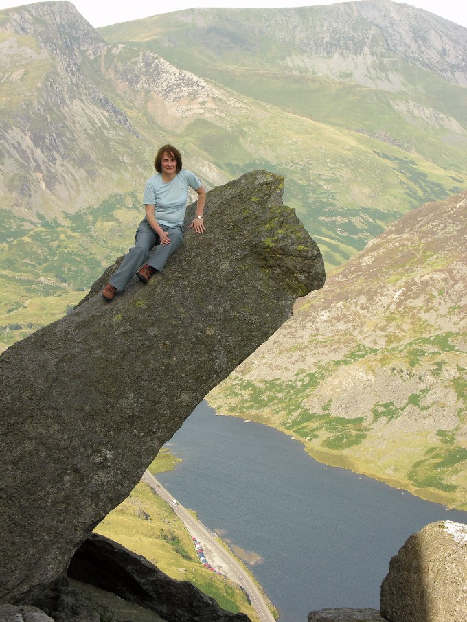
Part way up is the “Cannon” which is a must for posing as if hanging over the valley whilst actually being only a few feet off the ground. Stopping briefly to pose on the Cannon we soon reached the summit where once more we declined the chance to jump between the Adam and Eve rocks. The wind gave a useful excuse this time.
On down past the south peak for a snack behind the wall in the bwlch and then a decision not to attempt bristly ridge in the wind now whipping through the gap between Tryfan and Glyder Fach.
So a trudge up the scree to the left instead, remembering in the process what an awful route it is.
But before too long we were doing our next posing session at the Cantilever, not too near the end today though, gusty winds making it feel a little less secure than we would have liked.
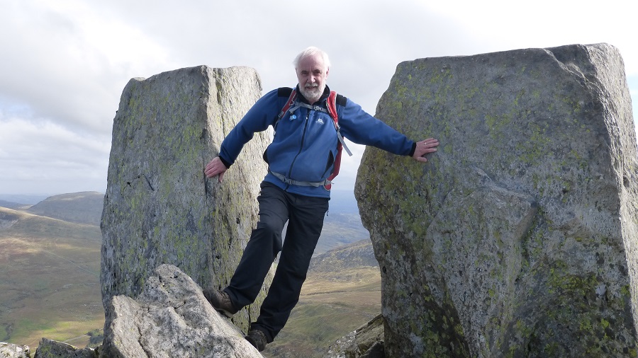
The top of Glyder Fach lies a little along the ridge and is somewhere within the jumble of huge rocks. We just hopped and jumped until we could get to what looked like the highest point and were lucky to find the trig point which here consists of just three brass studs.
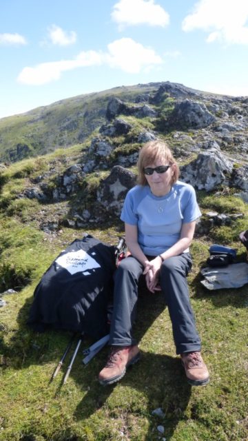
This led to a very uncomfortable summit picture of myself hanging onto a rock. Linda took the sensible option of moving one rock lower. which we decided was close enough as she could actually touch the top one and it did allow a bit of the view to be included.
On then along the wide ridge to Castell Y Gwint (“castle of the winds” which today was very aptly named) and a short and steep descent before the climb alongside Cwm Cniefion (The Nameless Cwm) up to Glyder Fawr. This is not the most inspiring summit to be fair, but they all count. There was chap here wandering about as if looking for something, or maybe he was doing that thing where you go the wrong way and try to look like you meant it?
(This is the most useful thing having a phone gives you. If you find yourself walking the wrong way down a road and are too embarrassed just to turn round, pull out your phone, look at it, and then with a huge shrug spin round and off you go!)
From here there is a steep descent to the top of the Devil’s Kitchen. We had the usual debate as to if we had time to get the last summit or whether we needed to go the steps into Cwm Idwal. We decided we did as long as we hurried, and we were correct. In fact as it turned out we had enough time to have walked up it backwards. Does Nasmith not apply in Wales in October?
From the summit we followed a delightful ridge back down into the valley. As the evening drew in the wind dropped and we dawdled on the shores of Lyn Idwal before walking back to car and bringing our Snowdonia adventures to a close for the year.
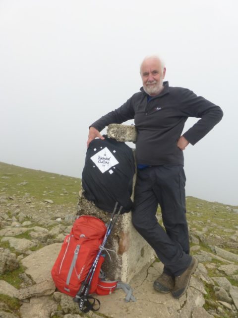
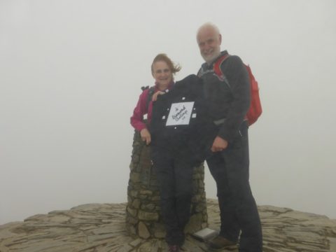
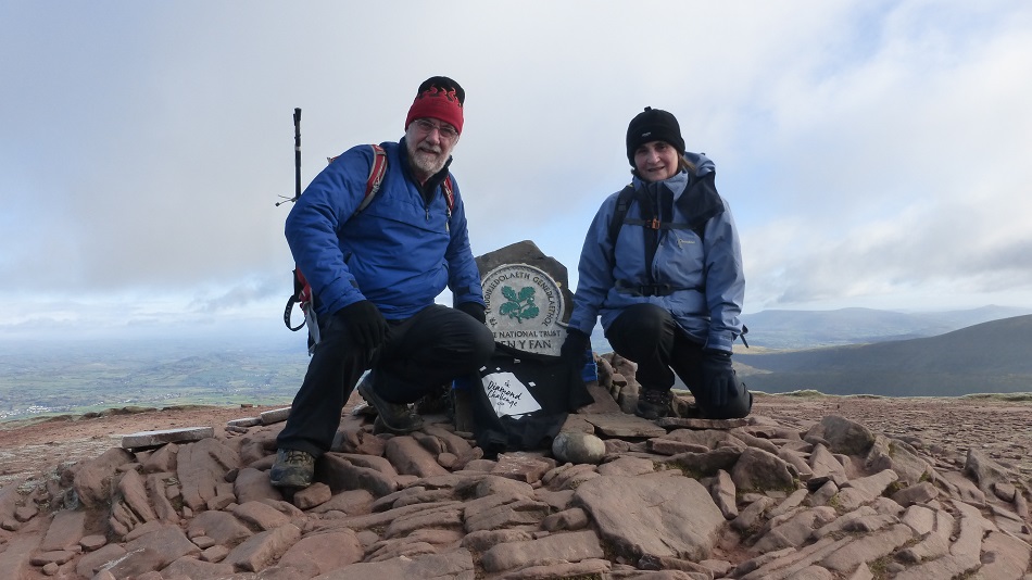
Pen-Y-Fan – Hill 20
Living in the Forest of Dean in Gloucestershire as we do the Brecon Beacons & Black Mountains are effectively our “local” hills and although we walk there quite often we seldom tackle the central peaks of which Pen-Y-Fan is the highest. This despite there being several good walks which take this peak in. Basically it’s the South Wales equivalent of Snowdon – a honeypot that every weekend is crawling with people.
However it is the 19th highest Hewitt in Wales so it had to be done. Even in November and starting out early we still struggled to get a space in the car park at Storey Arms but we were lucky and for once avoided parking on the roadside verge. We had decided to repeat a route we had done a couple of years previously by following the “tourist” path up from the main car park and then descending from Corn Du and on crossing the stream taking a left-turn to follow the stream back to the start point.
The ascent from the car park is part of the Beacons Way, a 95 mile route that traverses the National Park established in 2005. (The route was revised in 2016 so if you have an old map then you should check out the changes) The suggested direction of travel is east to west which takes you from “The Holy Mountain” to “Bethlehem”. Maybe arriving in time for Christmas?
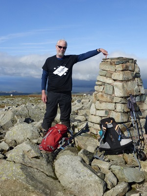
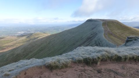
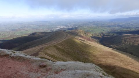
The path leads up to Bwlch Duwynt and skirts past Corn Du to reach Pen-Y-Fan. As you can see in the picture there was a hoar frost in the top part of the hills making today a pretty cold journey.
The top is a large plateau with a low cairn and name plate. Views from here are stunning in as much as you can see what appears to half of Wales to the north. There are ridges leading north from each of the peaks giving a choice of several horseshoe routes from that direction. To the south the Gwaun Taf valley is is surrounded by the classic “Southern Horseshoe” taking in a lovely ridge walk together with the three major Beacons.
Today once the summit picture had been taken we set off back to Corn Du and down the steep path towards the Tommy Jones obelisk before taking the direct path back to Storey Arms.
Crossing the stream and climbing for a few yards we found the path heading south above the watercourse and followed that back to the car before opening the small bottle of champagne to celebrate completing our challenge.